North and Middle Caicos Stand-up Paddleboarding
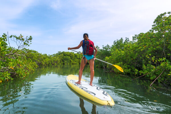
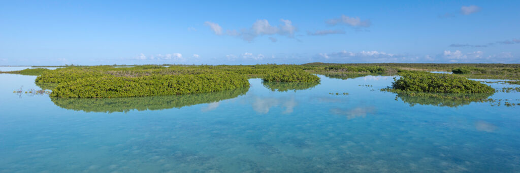
Paddleboarding (also known as stand-up paddleboarding or SUPing) on North and Middle Caicos is a mixed situation. Both islands offer huge and extensive wetlands and mangrove channels (much of which are virtually never visited by people), yet rentals and guided tours are lacking due to the limited tourism on these islands.
To get a really good paddling experience, you will have to plan a little in advance. It may also be necessary to transport your boards on land by vehicle to the best launch location. However, we generally recommend that those who want to paddle and explore the wetlands of North Caicos and Middle Caicos travel with a guide for ease of equipment transport and navigation.
For more information, see the Paddleboarding Overview page.
Wildlife
The mangrove wetlands and waterways are the nurseries of the marine environment in the Turks and Caicos. Juvenile lemon sharks (typically only 1–2 feet, or 0.3–0.6 meters, long), turtles, conch, and fish are abundant in most channels. Above, herons (tricolored, great blue, green-backed, and yellow-crowned night), egrets (reddish, great white, and cattle), pelicans, and flamingos can be seen.
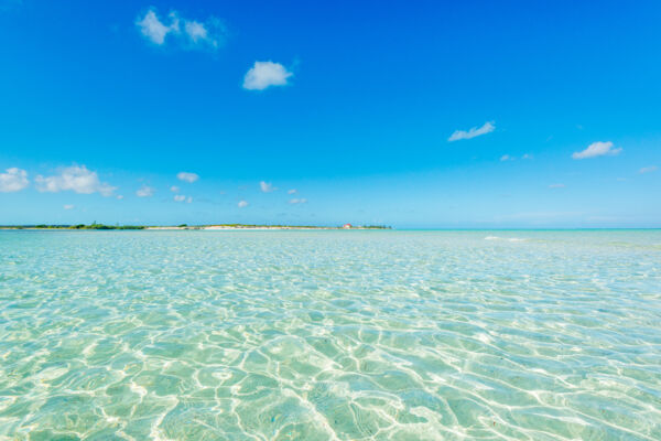
Polarized sunglasses are great to have when paddling, as they significantly cut down on water surface reflections and allow for a much clearer view of the interesting creatures below.
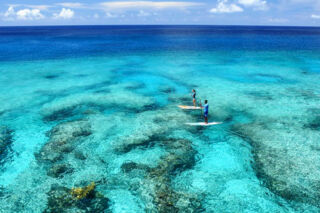
Locations
The beautiful Bottle Creek is the most popular paddle sports spot on the two islands, mainly due to ease of access. Here, a wide, shallow lagoon separates North Caicos from the nature sanctuary of East Bay Islands National Park.
Because of the openness of Bottle Creek, surface conditions can get quite choppy and windy. If you make the journey across Bottle Creek to the northern coasts of the cays (about 3–4 miles, or 5–6.5 kilometers), expect secluded beaches, excellent beachcombing, and abundant birdlife on the uninhabited Bay Cay and East Bay Cay.
The southwest coast of North Caicos offers extensive mangrove networks and is the best spot for launching a boat on an excursion from Providenciales. Largely unexplored by kayak or stand-up paddleboard, the sheltered channels are home to juvenile sharks and turtles, and the larger open ponds have flocks of flamingos and larger wading birds. Bellefield Landing is a decent point to launch from if you want to access this area.
Although remote, Lorimers Creek offers some great areas for exploring. There are two feasible launching spots: Lorimers Landing in the tiny village of Lorimers and Cedar Point at the end of Wild Cow Run. Possible destinations include the scenic islands of Joe Grant Cay and Dickish Cay.
Consider the wind. The wind is typically the biggest challenge when paddleboarding, as the body acts as a sail, and it can be difficult to fight your way upwind depending on conditions. Starting your journey by heading into the wind makes your return trip much easier.
Be aware of currents. There are countless channels and bottlenecks between the cays and small mangrove islands around North and Middle Caicos. During the natural rise and fall of the tides, there can be significant water movement in these areas. Although these currents don’t pose much of an actual danger, you can avoid unnecessary fatigue by paying attention to your surroundings.
Take plenty of water with you. The sun in the Turks and Caicos can be intense, so avoid dehydration by drinking plenty of water. Aim for about one gallon (4 liters) per person per day when in the sun. Bring more than you expect to use, in case you run into difficulties.
Don’t get lost. The south sides of North and Middle Caicos have vast areas of maze-like mangrove networks. We recommend that you familiarize yourself with the area by examining maps and taking a suitable GPS unit. Or, go with a guide who knows the area. In the past, tourists have gotten lost in these areas on jet skis due to not having any navigation equipment.